Land surveying traditionally required specialised equipment and trained professionals. However, with the advancements in GPS technology, it is now possible to survey an area just using your phone. This article will explore how you can use GPS on your phone to effectively land survey an area, using tools like the Land Survey App and Quality Control App from NestForms.
The Role of GPS in Land Surveying
GPS, or Global Positioning System, is a satellite-based navigation system that provides location and time information anywhere on Earth. It consists of a network of satellites that orbit the Earth and transmit signals to GPS receivers, such as those found in smartphones. These receivers use the signals to calculate their precise location, enabling users to determine their position with remarkable accuracy.
In land surveying, GPS technology has become an invaluable tool. It allows surveyors to accurately measure distances, angles, and elevations, as well as create detailed maps and drawings. This level of precision is essential for various applications, including construction, engineering, and environmental monitoring.
The Benefits of Using GPS on Your Phone for Land Surveying
Using GPS on your phone for land surveying offers several key benefits:
- Convenience: No more lugging around heavy equipment and paper maps. With just your phone, you can easily survey an area at any time.
- Cost-Effectiveness: Traditional land surveying equipment can be expensive to purchase or rent. By using your phone, you can save on costs while still obtaining accurate data.
- Accuracy: GPS technology has come a long way in terms of accuracy. By utilising your phone's GPS capabilities, you can obtain precise measurements and data for your land surveying needs.
- Real-Time Data Collection: With GPS on your phone, you can collect data in real-time and instantly upload it to the Cloud for analysis and sharing.

How to Use GPS on Your Phone for Land Surveying
To effectively land survey an area using GPS on your phone, follow these steps:
Download a Land Survey App: Start by downloading a reliable Land Survey App such as the one offered by NestForms. These apps are designed specifically for land surveying and offer features that make the process simple and efficient.
Calibrate Your Phone's GPS: Before you begin surveying, make sure your phone's GPS is calibrated to ensure accurate results. You can do this by accessing your phone's settings and enabling high-accuracy mode.
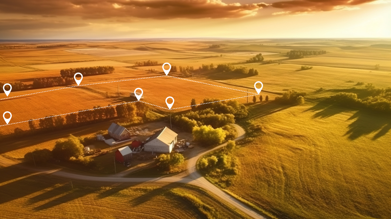
Plan Your Survey Route: Determine the perimeter of the area you wish to survey and plan your route accordingly. This will help ensure you cover the entire area and collect all necessary data. NestForms includes a Calculate feature to assist with this task.
Start Surveying: Use the app to start surveying the area, following the designated route. The app will track your movements and collect data such as distance, elevation, and coordinates.
Quality Control: Utilise the Quality Control App from NestForms to ensure the data collected is accurate and reliable. This app allows you to review and verify the collected data before finalising the survey.
Land Survey Apps: A Closer Look
One such app is the Land Survey App by NestForms. This app is designed to streamline the land surveying process and improve the quality control of survey data. It offers a range of features that make it an indispensable tool for surveyors:
GPS Integration: The Land Survey App integrates seamlessly with the GPS capabilities of your Android or iOS smartphone, allowing you to accurately determine your location and measure distances, angles, and elevations.
Customisable Project Completion Forms: The app allows you to create customisable survey completion forms tailored to your specific needs. You can add various types of questions, including Single, Multiple answers Dropdown menus. You can also provide text, and images to collect the data you require.
Offline Data Collection: The app supports offline data collection, allowing you to conduct surveys in remote areas without an internet connection. Once you're back online, the app will automatically sync your data to the cloud.
Quality Control: The app includes built-in quality control features to ensure the accuracy and reliability of your survey data. You can set validation rules, perform data checks, and generate detailed project completion reports.
Collaboration: The app supports collaboration among team members, allowing multiple users to work on the same survey simultaneously. This collaboration can improve efficiency and accuracy by enabling real-time communication and feedback.

Experience the Ease and Efficiency of GPS Land Surveying with NestForms
NestForms offers a comprehensive suite of features designed to streamline the land surveying process. With the Land Survey and Quality Control App, you can experience the ease and efficiency of GPS land surveying right from your phone. You can eliminate some of the cumbersome equipment and lengthy data collection processes, allowing for accurate and more reliable results at your fingertips.
By incorporating GPS technology into your land surveying process, you can save time, money, and resources while obtaining accurate and reliable data. With the right tools and features, such as the ones provided by NestForms, land surveying has never been easier. Dive into the world of GPS land surveying today and experience the difference for yourself.
GPS technology has revolutionised the field of land surveying, making it more accurate, efficient, and accessible than ever before. By using GPS on their smartphones, surveyors can achieve precise results without the need for expensive equipment. Whether you're a professional surveyor or a homeowner looking to map out your property, GPS technology can help you get the job done quickly and accurately.
Don't miss out on the opportunity to revolutionise your land surveying efforts. Try the NestForms' GPS-enabled app today and see the difference for yourself!
You can get started in an instant and learn more about how our offline survey app works.
Try out NestForms mobile form app by signing up for our free two week trial.
As soon as you enable the free trial you can get stuck into creating your first form using the easy drag-and-drop form builder! The NestForms surveying app is so simple to use and install!
During the free trial you can test out each feature and module included within the optimum Premium plan subscription.
We look forward to hearing from you.