
A survey can take hours to complete. The information collected may be used for planning, compliance, construction work, land records, environmental studies, or client reports.
If the data is incomplete or difficult to access later, the cost of correcting mistakes can be significant.
That is why choosing the right surveyor app matters. The best tools do more than replace paper forms. They help surveyors collect accurate information, organise data, and produce clear reports from the field.
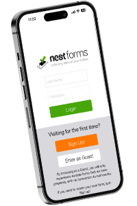
NestForms is one example of a surveyor app designed to support data collection, reporting, and field operations from a mobile device.
What Is a Surveyor App?
A surveyor app is a mobile application used to collect information during site visits.
Depending on the type of survey, this may include:
- GPS locations
- Photographs
- Measurements
- Inspection findings
- Notes and observations
- Signatures
- Punchlist forms
- Checklists
- Asset information
- Installation forms
- snag list form
- A completion form
The information is captured on a mobile form app and stored digitally rather than on paper.
Why Do Surveyors Use Mobile Apps?
Field teams often work across multiple locations in a single day.
Paper forms create extra administration. Notes may need to be typed up later. Images must be matched to reports. Missing information may require another site visit.
A good mobile survey app keeps everything together during data collection.
The surveyor can complete the survey once and generate a report from the same information.

What Features Should a Good Surveyor App Include?
Not every app is designed for field survey work.
These features are often the most useful.
GPS Data Collection
Location information is a key part of many surveys.
A quality GPS survey app should allow surveyors to record locations automatically without manually entering coordinates.
This helps create a clear record of where observations were made.
Offline Working
Many surveys take place where mobile coverage is poor.
A reliable offline survey app allows data collection to continue without an internet connection.
The information can then synchronise automatically when coverage returns.
Image Capture
Images provide supporting evidence for survey findings.
A good land survey app should allow photographs to be attached directly to questions within the survey.
This removes the need to organise images separately later.
Custom Forms
Different survey types require different questions.
Whether carrying out a boundary survey, environmental survey, utility survey, or site inspection, the app should allow forms to be customised without specialist development.
A flexible form builder app gives surveyors more control over their processes.
Reporting
Collecting data is only one part of the task.
Surveyors also need professional reports.
The best surveying app solutions can generate reports automatically using the information captured during the survey.
How Important Is Accuracy?
Accuracy affects every stage of a survey.
Missing photographs, incorrect locations, or incomplete notes can create delays and extra work.
A good GPS land survey app helps improve consistency by guiding the surveyor through a structured process.
Mandatory questions, validation rules, and predefined answers help reduce omissions.
Can a Surveyor App Be Used Across Different Survey Types?
Yes.
Many organisations use the same platform for multiple survey activities.
In fact the best surveyor app must be flexible to adapt in different conditions.
Common examples include:
- Boundary surveys
- Utility surveys
- Environmental surveys
- Construction surveys
- Site planning surveys
- Asset inspections
- Property condition surveys
- Work completion reports
- Project completion reports
- Health and safety audits
- Punch list application
The ability to create different forms makes the app suitable for a wide range of field activities.

What Makes Reporting Easier?
Surveyors often spend almost as much time producing reports as collecting information.
A good mobile data collection app reduces this workload by generating reports automatically from completed surveys.
Images, GPS locations, signatures, and responses can all be included in a standard format.
This allows reports to be shared more quickly with clients and colleagues.
Is a Surveyor App Suitable for Small Teams?
Many people assume survey software is designed only for large organisations.
In reality, small businesses often see the biggest benefit.
A single surveyor can save significant administration time by moving away from paper-based processes such as using Nestforms as a digital snag list app!
Larger organisations gain additional advantages through standardisation and easier reporting across multiple teams.
Choosing the Right Surveyor App
The best project completion form apps for surveyors help field teams collect information accurately, work offline, capture GPS data, attach photographs, and generate reports without unnecessary administration.
When comparing options, focus on how easily the app fits into your existing workflow rather than the length of the feature list.
A surveyor app solution should help inspectors spend less time managing paperwork and more time completing surveys.
With the NestForms quality control app we offer a free Training Demo as an introduction to the platform if you need it. For larger operations we also provide more detailed Assisted Onboarding.
Test out nest forms by trying our punch list form construction template !
Start your NestForms offline surveys journey today and sign up for the free two week trial. You can review and test all of the features available to Premium plan users during this period.